Key Considerations
The applicant is working with a team of technical and environmental consultants to develop a proposal; we have had regard to the following:
Highways and access
The main vehicle access will be from St Peters View, with an emergency access point from Egg Lane. The layout will be designed to allow safe and easy movement for pedestrians, cyclists, and vehicles. An existing public footpath along the north-west boundary will be improved, offering a convenient walking route to the school, local shops, and village centre.
A Transport Assessment (TA) will support the planning application which will examine the likely transport implications on the surrounding area, consider the proposal against the relevant transport policy considerations, and assess the locational sustainability of the site. The TA highlights the following:
- The site is well located for residential development, with the surrounding area having good levels of pedestrian, cycling and public transport infrastructure, providing access to local amenities;
- Key amenities are accessible within the recommended walking and cycling distances;
- A review of the latest five-year personal injury collision data for the surrounding area does not indicate any existing highway safety issues that would warrant mitigation as part of the development;
- Traffic flows on the network are generally light and well within the capacity of the network.
- The site access arrangement has been demonstrated to be safe and suitable to accommodate the proposed development; and
- Predicted trip generation will be negligible during peak periods and there will be no discernible impact on the local road network as a result of the development.
And concludes that the proposed development will not give rise to any material transport related impacts and therefore meets the test of the NPPF and paragraph 116, which states that ‘development should only be prevented or refused on highways grounds if there would be an unacceptable impact on highway safety, or the residual cumulative impacts on the road network, following mitigation, would be severe..’.
Drainage
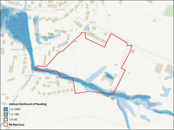
Whilst the site is located wholly with Flood Zone 1 parts of the site are affected by surface water drainage issues. There is a small water channel and an underground pipe across the site. Our drainage strategy envisages incorporating one attenuation pond, swales and underground storage tanks. This will manage rainwater carefully and avoid any impacts on nearby homes or land. A Flood Risk Assessment and Drainage Strategy will support the proposals.
Landscape and visual impact
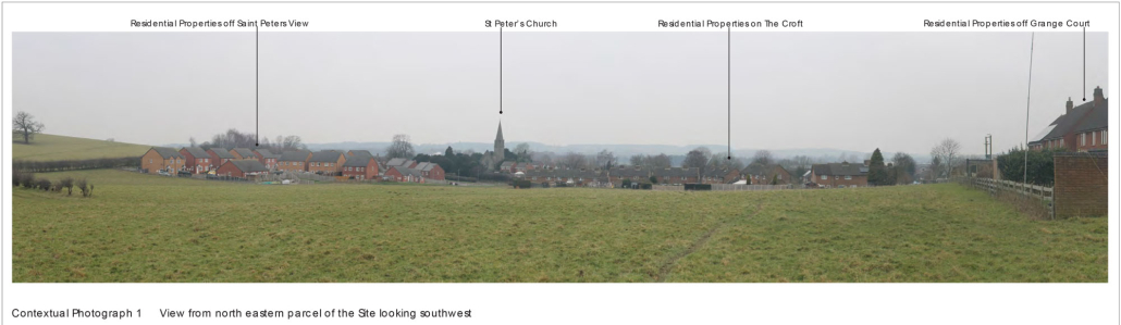
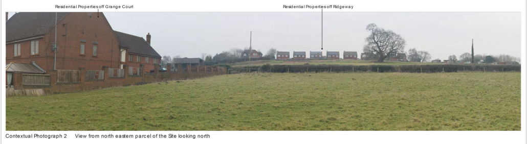
An assessment of the site’s suitability to accommodate the proposals and which discusses the potential landscape and visual effects of the development on the wider area has been undertaken to inform the proposals. It concludes that the site has medium landscape value and medium-low landscape susceptibility. The containment of the site within the landscape and the retained and proposed vegetation on the site’s boundaries mean that the effects of the proposed development on the wider landscape/townscape area will be minimal. The development is considered to be a logical extension to the settlement that would be well contained physically and visually.
Heritage
A Heritage Assessment has been undertaken to review the known and potential heritage resource including archaeology, built heritage and historic landscape. It assesses the significance of the heritage resource which may be affected, and the potential impact of proposals on that significance. The report concludes the following:
- There is limited evidence of prehistoric or Roman period activity
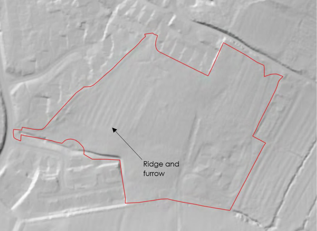
- Remains of ridge and furrow earthworks are present in the western area of site – they are not however identified as a heritage asset.
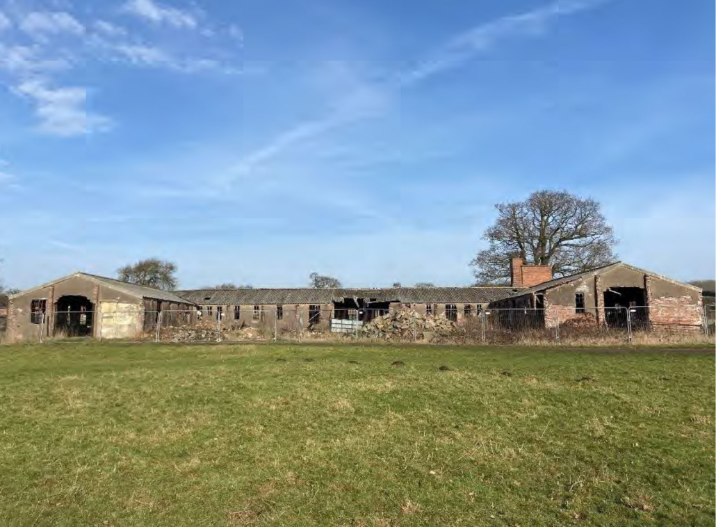
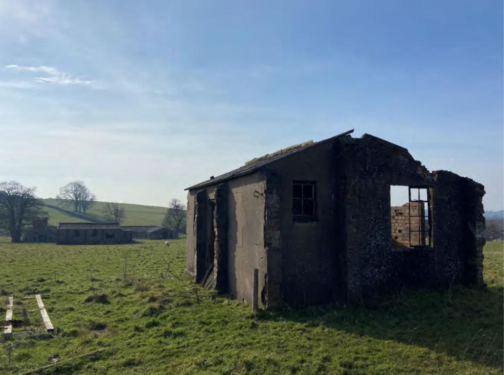
- WWII buildings associated with the former RAF Hixon Military Hospital Complex (sick quarters) are located in the eastern area of the site. These include the main hospital block and annex, an air raid shelter, an ambulance garage/mortuary and a picket post. The building is of standards WWII construction, intended to be temporary and as such as non-designated heritage assets.
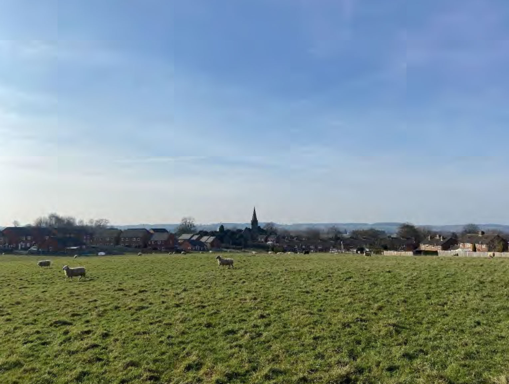
- Development of the site would alter the wider agricultural setting of the Grade II listed Church of St Peter, a 19th Century Gothic Revival church. The proposed layout includes a view corridor to safeguard views towards the church from Egg Lane, and within the site. Harm to the setting of the church is considered to be less than substantial as a result.
Trees
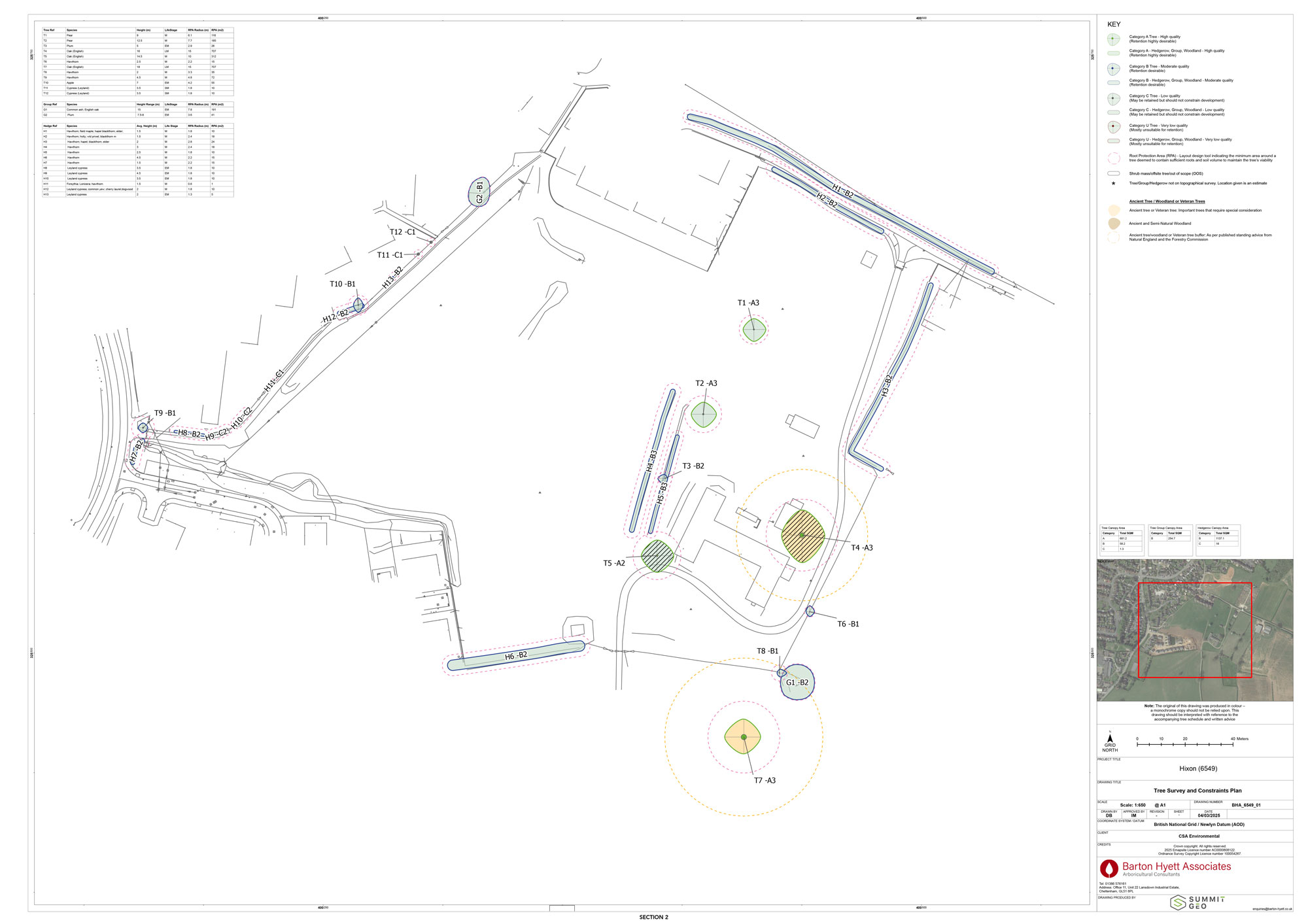
A tree survey has been undertaken to inform the layout of the site. It has revealed that there are some important oak trees on and near the site which includes:
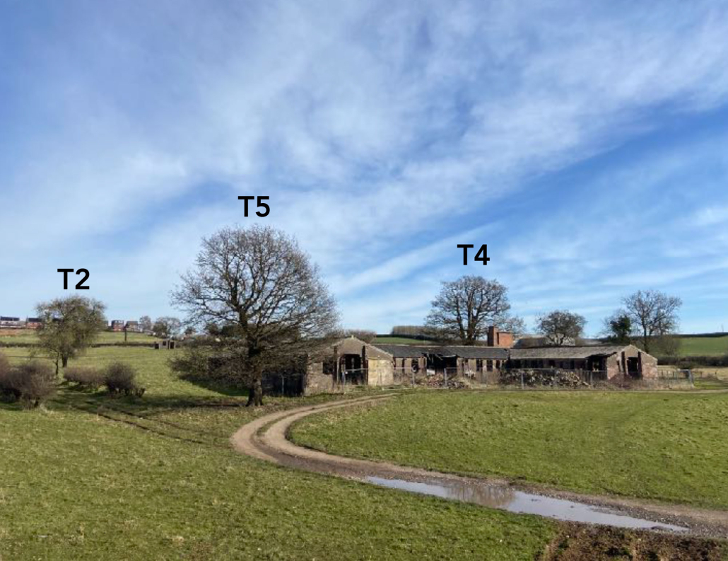
- A veteran Oak tree (T4) which is protected by a Tree Preservation Order
- Offsite ancient oak tree (T7)
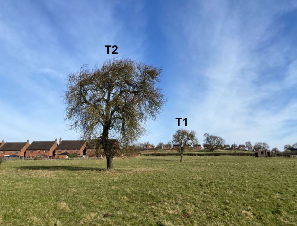
- Remnant Pear trees ( T1 and T2) both category A trees which formed part of an orchard visible on the ordinance survey maps for the site from 1880-1922.
- Mature Oak T5 which is located at the southwestern corner of the former hospital building
- Hedgerows H4 and H5 within the centre of the site were historically laid to mark the former lane that connected Grange Farm to the White Barn to the southThese trees will be retained protected and kept in place with open space around them.
Ecology
A Preliminary Ecological Appraisal has been undertaken to identify any ecological constraints to development, to inform scheme design, highlight opportunities for ecological enhancement and determine the need for any additional survey work. Key findings so far are:
- The site lies within 1km of the Pasturefields Saltmarsh Special Area of Conservation ( SAC), Site of Special Scientific Interest and Staffordshire Wildlife Trust Nature Reserve and within 4.6km of Cannock Chase SAC – sensitive mitigation strategies will be required to prevent negative impacts on these designations.
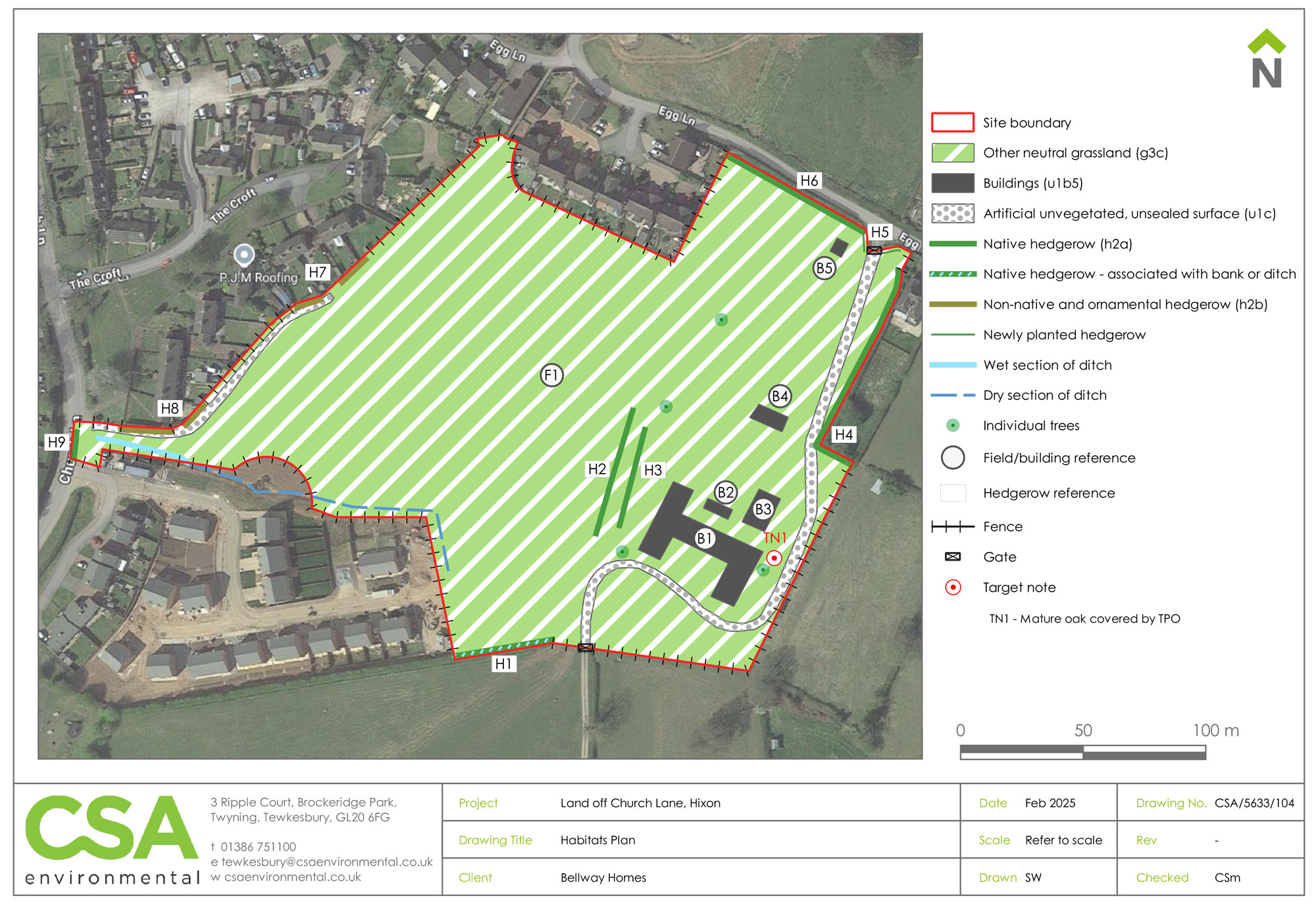
- Habitats present within the site are generally common and widespread consisting of a single grassland field, derelict buildings and hedgerows and trees.
- The greatest ecological interest is associated with the mature and veteran trees.
- Absence/presence surveys are recommended for great crested newts, bats and nesting birds.
- We’ve identified some valuable wildlife habitats, including hedgerows and trees, and will be doing further surveys to make sure any species like bats or birds are considered in the plans.